Stamping out wildfires.
ALERTWildfire uses a network of Axis PTZ cameras to track wildfire outbreaks, pinpoint ignition sites, monitor conflagrations, and inform incident command decisions on deploying resources and initiating evacuations.
Automating fire spotting
The rise in massive wildfires, especially in the western United States, has had a devastating impact on human lives and property, and caused enormous ecological damage to local habitats. Recognizing that early detection gives firefighters a greater chance of containment, young students from Meadow Vista, California approached the Nevada Seismological Laboratory at the University of Nevada, Reno to help them design a social media empowered technology solution to improve fire spotting.
Their award-winning AlertTahoe pilot program, which focused on the region surrounding Lake Tahoe, called for seeding the forest with pan-tilt-zoom (PTZ) video cameras connected to a microwave network to watch for ignition points and alert local fire stations. The students also included an innovative social media component to enable the public to view the live streaming video and serve as additional forest guards.
The 4-year-long pilot led to the launch of ALERTWildfire, a project initially headed by a consortium of three universities (University of Nevada, Reno, University of California San Diego, and University of Oregon). Since then other universities and partners have joined the project, including many local municipalities, state and federal agencies, public utilities, wireless internet services providers, local fire departments, and ski resorts, as well as a cadre of citizen volunteers.
Combining keen eyes and towers of opportunity
“What we’ve done is build the modern-day fire tower,” says Dr. Neal Driscoll, professor of geosciences at the University of California, San Diego.

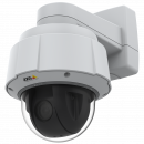
While no two sites are the same, most lookout stations include two Axis cameras looking at the area from two different angles to determine the field coordinates of the fire. Each camera is self-sufficient with solar and battery backups and a microwave link to transmit the live images to a public website where anyone can watch online along with firefighters.
At the request of ALERTWildfire, Axis Professional Services developed custom firmware to give their system access to the cameras’ pan, tilt and zoom positions. “Making these data available help incident commanders calculate a fire’s exact coordinates and redirect specific cameras to that geolocation so they can better monitor the fire’s behavior and path of destruction,” says Craig Binford, Northern California Regional Sales Manager for Axis Communication.

The custom software also allows ALERTWildfire users to create time-lapsed videos of fires that they can share with the public and use for fire containment and forest management research.
“When we first started this project, we played with some donated security cameras,” explains Dr. Graham Kent, Director of the Nevada Seismological Laboratory at the University of Nevada Reno. “But they weren’t high-definition, and they didn’t have near infra-red.”
Then the team tried out a pair of Axis Q-line PTZ network cameras. The experience was jaw dropping. “Within hours of installing the Axis cameras atop Snow Valley Peak, Nevada’s Bison Fire took off,” recalls Dr. Kent. “We couldn’t believe how clear the image was. And then watching the cameras shift into nighttime and near infra-red, we knew our project was heading for success.”
Dr. Driscoll, observed that, “On a clear day, the cameras could see about 70 miles. At night, using the near infra-red, they could see 100 to 120 miles.”
Since then Axis has continued to improve its camera technology thanks, in part, to feedback from ALERTWildfire personnel.
Early on, the Nevada Seismological Laboratory garnered support from a local NGO, the Tahoe Prosperity Center, United States Forest Service, and the Nevada Bureau of Land Management to help build out the fire watch solution across the region. When the project expanded farther into California and Oregon, the team grew with the additions of UC San Diego and the University of Oregon and began to foster collaboration with local industry and utilities.
ALERTWildfire proved its value with the first southern California installation. “When the fast-moving Lilac Fire erupted in northern San Diego County, says Dr. Driscoll, “Tony Mecham, the CAL FIRE San Diego Unit Chief was able to reposition his assets based on live data streaming from the Axis cameras.”
In the past, firefighter commanders would have to send an engine to the fire to assess the situation and decide what resources to dispatch. Waiting for an engine and a unit to arrive on the scene and report conditions on the ground could delay a response by 20 to 30 minutes while the fire continued to burn unchecked.
“Now, thanks to the Axis cameras, incident chiefs can make those decisions within seconds right from the fire station,” says Dr. Driscoll. “Sometimes their dispatchers will start moving additional resources towards a fire even before the first firefighters reach the location and start asking for support.”
The actionable, real-time data the Axis cameras provide have made a huge difference in how quickly incident commands can assess a situation and marshal the necessary resources. It’s become a real game changer in terms of wildfire containment and public safety.
Having the public play an active role
When the Kincaid Fire slipped down the mountain, the area residents logged onto the website (www.alertwildfire.org) to watch. “The images filled the social media channel warning people to get off the mountain,” says Dr. Kent. By the time the fire was contained, nearly 150,000 people had evacuated. Some 80,000 acres and over 300 homes were lost, but there were zero fatalities or injuries in stark contrast to the nearby Tubbs Fire in 2017.
Dr. Kent recalls, “People’s lives and homes were saved that night. That would not have been possible if it weren’t for that camera work and the brave first responders of CAL FIRE and others. And to this day, it’s the proudest moment in my career.”
Especially during fire season, there are often hundreds of citizens monitoring the cameras on the ALERTWildfire website and reporting their observations over social media. “The general public is very good about calling in fires early,” says Dr. Kent. “The children from Meadow Vista had it right!”
“We think of the social media aspect as an early confirmation system, a 9-1-1 call if you will,” explains Dr. Driscoll. “Once an alert is posted, first responders can remotely zoom in or point the cameras in the right direction to confirm ignition and the location coordinates, which greatly helps to expedite a response.”
Both Dr. Kent and Dr. Driscoll feel that public participation in the project has been instrumental in getting firefighting resources to a number of fires while they were still small and easier to contain.
Getting it right the first time
Because the mountaintop sites are difficult to access, Professional Telecommunications Services, a certified SDVOSB and DVBE company, puts every Axis camera through a 12-step pre-qualification before shipping it out to an ALERT-Wildfire installation team.

“Quality assurance and pre-staging are critical when your installation often involves climbing permits and a team of technicians with mountain-climbing gear taking a four-hour drive to the middle of nowhere,” says Azarik Sivatjian, senior Account Manager for PTS.
Sivatjian admits the job gets a bit hectic at times as the project picks up steam. In the early years, PTS was staging between 50 to 100 cameras a year. Now PTS is shipping anywhere between 40 to 60 cameras every six weeks. “The stress is worth it,” says Sivatjian, “especially when you consider all the lives and property we’re helping to save.”
Beyond wildfire management
The growing success of ALERTWildfire has held a few surprises. “Though our focus has always been on fighting fires, we’ve discovered the system being used in a lot of ways we never anticipated,” says Dr. Kent. For instance, Care Flight, an air ambulance service, often logs onto the ALERTWildfire website to check flying conditions before heading to an emergency. Commuters are also frequent visitors to the website, viewing the real-time video to track snowstorm activity, snowpack, and road conditions.
While ALERTWildfire started out as a regional solution to improve fire spotting and containment, the team is already looking to expand the project across the United States and into Australia where a pilot is already underway. “With all the devastating wildfires happening around the world, we think there’s significant potential for this technology in other countries where human life and property are at risk,” says Dr. Kent.

Products & solutions

