Smart vessel tracking leads to safer river traffic
Windsor Port Authority uses Axis bispectral cameras and Accipiter radars to monitor river traffic along the U.S.-Canada border. They also help the Harbor Master prevent vessel collisions and detect smugglers crossing the shipping lane.

Managing traffic on a busy international waterway
The Windsor Port is located on the Detroit River, a waterway bordering the United States and Canada. Because it serves as the passageway between Lake Huron and Lake Erie, there could be 6,000 to 9,000 cargo vessels navigating the channel annually. In addition to commercial ships passing by or coming into port, over 10,000 small fishing boats and pleasure crafts weave their way through the congested waters.
“If I don’t have detailed knowledge of the traffic going through these waters, we could have some horrific accidents,” shares Peter Berry, Harbor Master and Vice President of Operations for the Windsor Port Authority.

For years, Berry relied solely on radar coverage to help him monitor river activity. The marine domain awareness platform from Accipiter Radar Technologies allowed him to identify commercial vessels, small craft, even jet skiers and debris in the water. “All of these objects show up as color-coded icons on my computer screen,” explains Berry. But the one thing lacking in the solution was the ability to see any visual details of those objects.
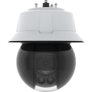
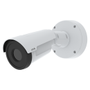
To address that limitation, Accipiter integrated Axis bispectral cameras into the platform. The dual-sensor cameras provide 360-degree surveillance with both thermal detection and visual verification. “Now when radar identifies a target, the Axis cameras visually confirm that target for me,” says Berry.
Berry asserts that the cameras provide such clarity that he can clearly read a license plate across the river which is almost a mile away. “Even in lowlight I can tell police that the camera saw four people onboard,” shares Berry. “If you’re going to intercept it, that’s valuable information to know.”

Automatically steering cameras to targeted vessels
“Accipiter is programmed to track the longitude and latitude of every vessel in the waterway,” explains Tim Nohara, President and CEO of Accipiter Radar Technologies. “It uses those coordinates to grab the appropriate camera and automatically steer it to a target without any human intervention. The software controls the camera’s pan/tilt/zoom and can even direct it to follow the vessel as it moves through the channel.”
If the Harbor Master wants to look closer at a certain area, he always has the option to click on the map or a radar target icon on his integrated radar display and redirect the nearest camera to that location for closer inspection.
Alone, the coastal surveillance platform provides wide-area, real-time detection and tracking coupled with on-the-fly and interactive analytics applied to historic target data. Augmenting the solution with Axis cameras adds a visual layer of awareness that further helps the Harbor Master make timely, informed decisions about his domain.

Broadcasting warning about obstruction in channel
One cold wintry day in December, the U.S. Coast Guard notified Berry that they’d spotted a boat stopped in the middle of the river. The grain carrier had caught fire, dropped anchor, and was dead in the water. “When I looked at the camera view on my computer, I saw that Accipiter had already pointed the camera at the vessel,” reports Peter Berry. “You couldn’t tell from the outside that it was on fire. But because the Axis cameras have a thermal aspect, I could see the heat signature of the fire and that it was contained in the ship’s engine room.”
Berry continued to monitor the flaring heat onboard the ship but also sent out a navigational warning to other vessels on the river, including the boat’s exact longitude and latitude as recorded by the Accipiter radar display. While the darkness of the hour prevented them from seeing anything from shore, the technology also provided thermal visuals to monitor activity on the bridge and deck. Thankfully everyone was safely evacuated. “Without these two technologies, we would have been blind,” claims Berry.
Monitoring high risk construction projects
The Harbor Master also serves as the general contractor for any construction projects at the port. “During construction of the new Gordie Howe Bridge we were concerned about material or construction workers falling into the river,” shares Berry. “I used the Axis cameras and integrated radars extensively to manage traffic passing underneath the bridge. It helped me ensure vessels navigated safely through the construction area.”
Managing a busy port along an international border can be quite challenging. Axis cameras and Accipiter radars give us the vital domain awareness we need to prevent collisions on our waterway, detect illegal activity, and save lives.

Conveying precise coordinates for faster rescues
Given how cold the Detroit River is in the winter, it wouldn’t take long for someone treading water to suffer hypothermia and drown. When Berry got a call from the U.S. Coast Guard that they had spotted a person frantically treading water by the Ambassador Bridge he looked at the radar icons on his screen and could see something moving and the coordinates of that location.
“I pulled up the camera and could see the person in the riverway,” states Berry. “I looked on the radar display to see what boats were in the area and requested a U.S. mail boat nearby to rescue him.” Once the person was retrieved, Berry sent a video snapshot to the Coast Guard confirming the rescue.
In the past Berry would have driven down to the river with binoculars and tried to spot the person and direct the rescue. “That would have eaten up valuable time that could affect the man’s chances of surviving hypothermia or drowning,” insists Berry. “In instances like this, minutes count. And the combination of Accipiter and Axis cameras provide me those minutes.”
Discovering human traffickers and drug runners
Berry reports that radar-camera surveillance has been instrumental in helping the Royal Canadian Mounted Police and the U.S. Border Patrol stem illegal border crossing. “We’ve used Accipiter’s data warehouse to spot trends and patterns,” explains Berry. “Then I go back to the archived Axis camera video to see what the cameras have picked up.”
Previously, encounters with smuggling events - guns, drugs, or people - were often left to chance, with Berry stumbling upon them while patrolling the waterfront. “Now I can sit safely in my office and discover these incidents remotely instead of driving into a potentially life-threatening situation,” shares Berry.
In one instance, when Berry queried the Accipiter database looking specifically for any objects crossing from Canada and to the United States, he received some surprising results. “I’d been hearing about this pontoon going back and forth across the river,” relates Berry. “While it looked like a typical pleasure craft, it was suspicious how regularly it sailed from a multi-million-dollar home in Windsor to a marina in Detroit.”
Berry turned the data and video over to the Canadian and U.S. authorities to investigate, which led to the arrest of two individuals running a human smuggling operation.
Adding an eye on the sky
“In the near future, we plan to introduce drone awareness on the platform,” reports Tim Nohara. “This will allow Berry to not only detect drones flying near the Windsor port, but to observe whether they’re carrying suspicious payloads.”
Special three-dimensional slew-to-cue software on the Accipiter platform enables the Axis cameras to smoothly rotate from surveilling the river to surveilling the sky.

Valuing technology partnerships
Berry sees the Axis-Accipiter solution as a great example of the partnership between industry and government. “The tight integration with Accipiter Radar Technologies was crucial, and the integration between the radar systems and Axis cameras was remarkably easy,” asserts Peter Berry. “For an application like this, top-end, purpose-built equipment is necessary - in this case, the Axis bispectral camera, which delivers exceptional performance even in challenging environments.” Berry also highlights the importance of organizational support throughout the project milestones, noting that both partners provided invaluable assistance every step of the way, ultimately contributing to increased marine domain awareness and enhanced safety along the border and Great Lakes.

Axis is proud to announce that the Windsor Port Authority project featuring the Axis Communications network camera and Accipiter Radar solution won in the Video Surveillance category of the 2025 SSI Security Solutions Awards! The annual Security Solutions Awards program, celebrates manufacturers and vendors whose electronic security solutions have been proven in the field to meet security, safety or other organizational needs for end users.
Products & solutions
Thermal cameras
Our partner organizations
Get in touch
Want to know how you can benefit from Axis solutions? Get in touch and we will help you.
Contact us
